
Дѣло:Balkans2010.png

Size of this preview: 650 × 599 пиѯєлъ. Other resolutions: 260 × 240 пиѯєлъ | 521 × 480 пиѯєлъ | 833 × 768 пиѯєлъ | 1.128 × 1.040 пиѯєлъ.
источьнъ дѣла обраꙁъ (1.128 × 1.040 п҃ѯ · дѣла мѣра : 135 Х҃Б · MIME тѷпъ : image/png)
| Сь видъ Викикладѣ (Wikimedia Commons) съхранѥнъ ѥстъ ⁙ Cѥ ѥгожє опьсаниѥ ѥстъ |
опьсаниѥ
| опьсаниѥ |
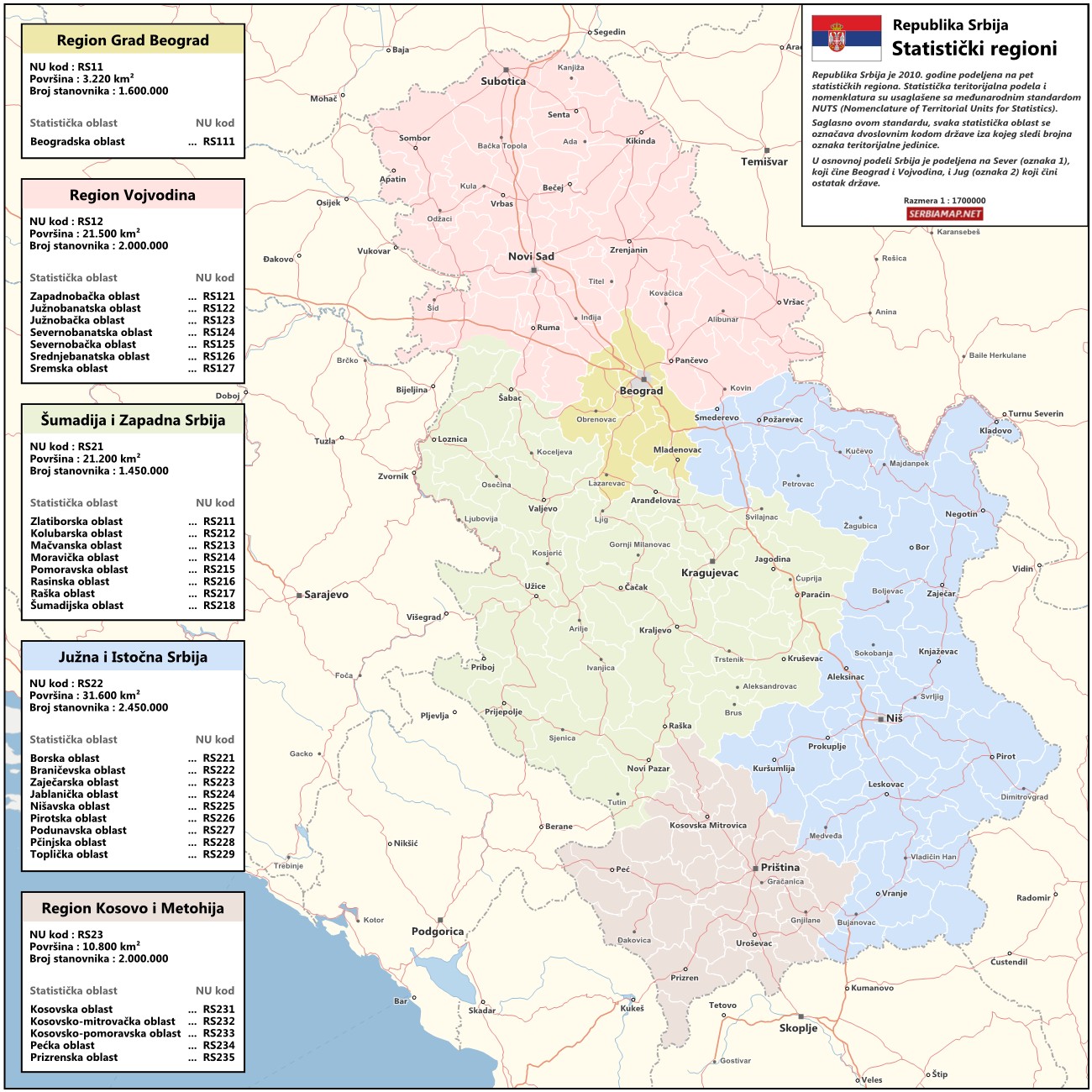
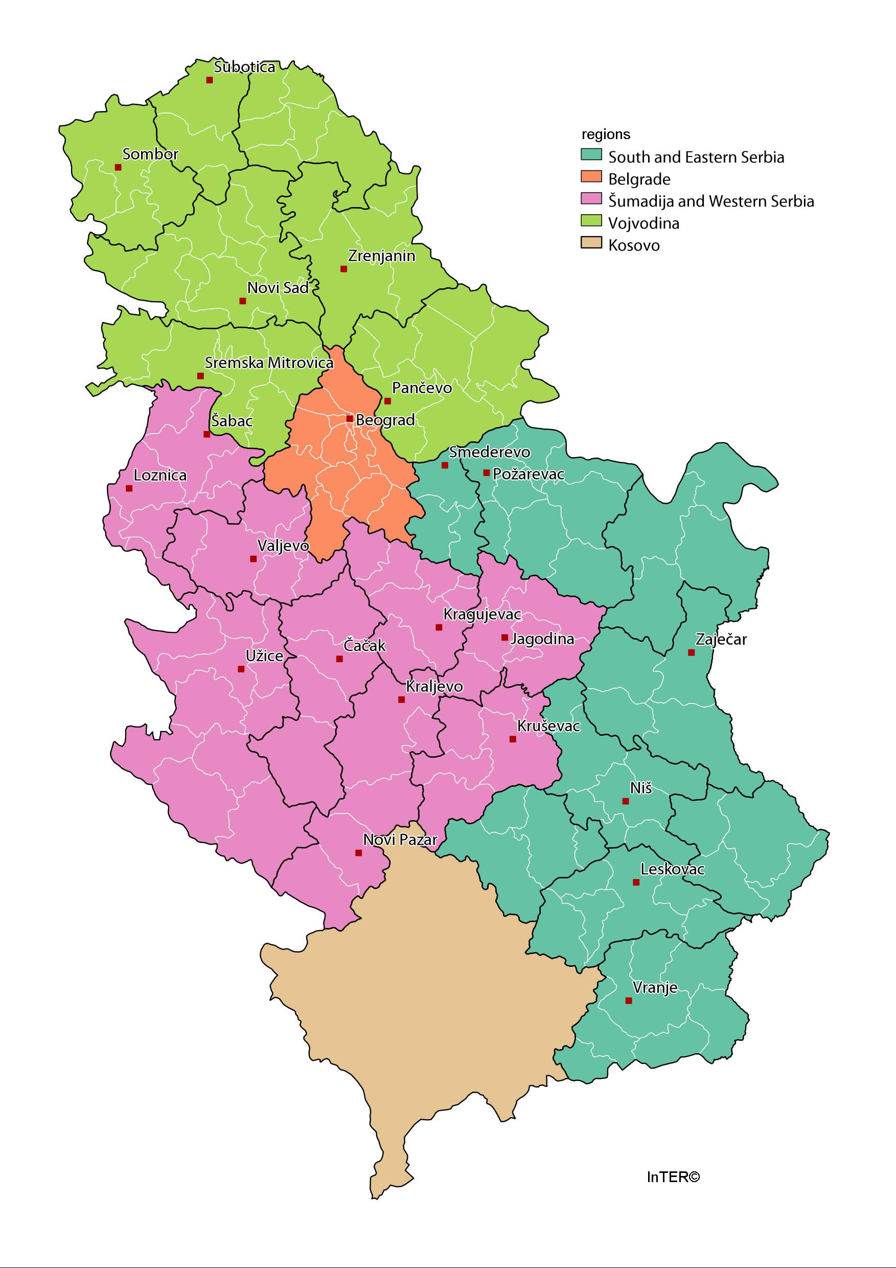
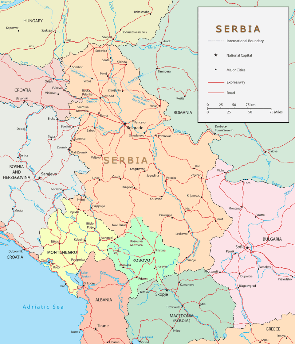
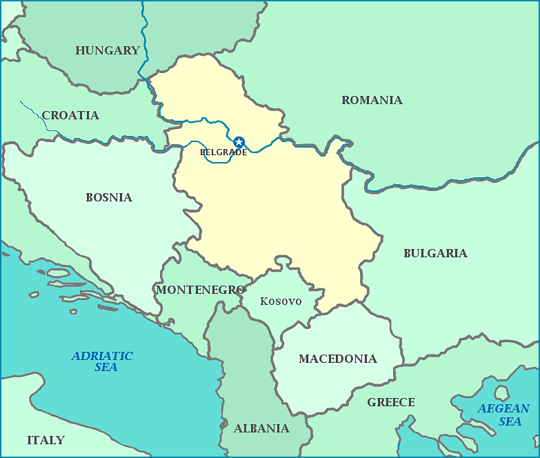
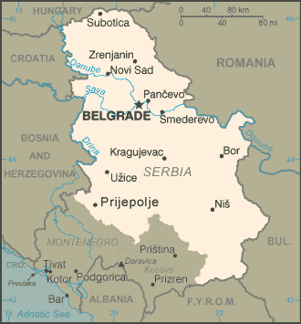
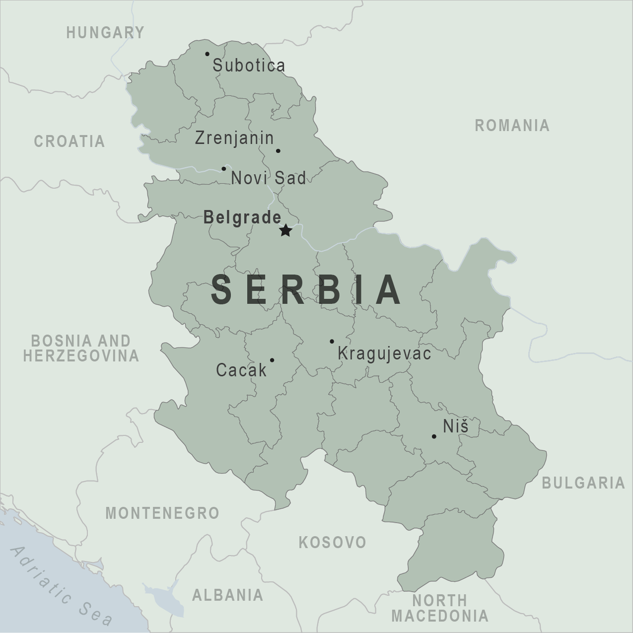
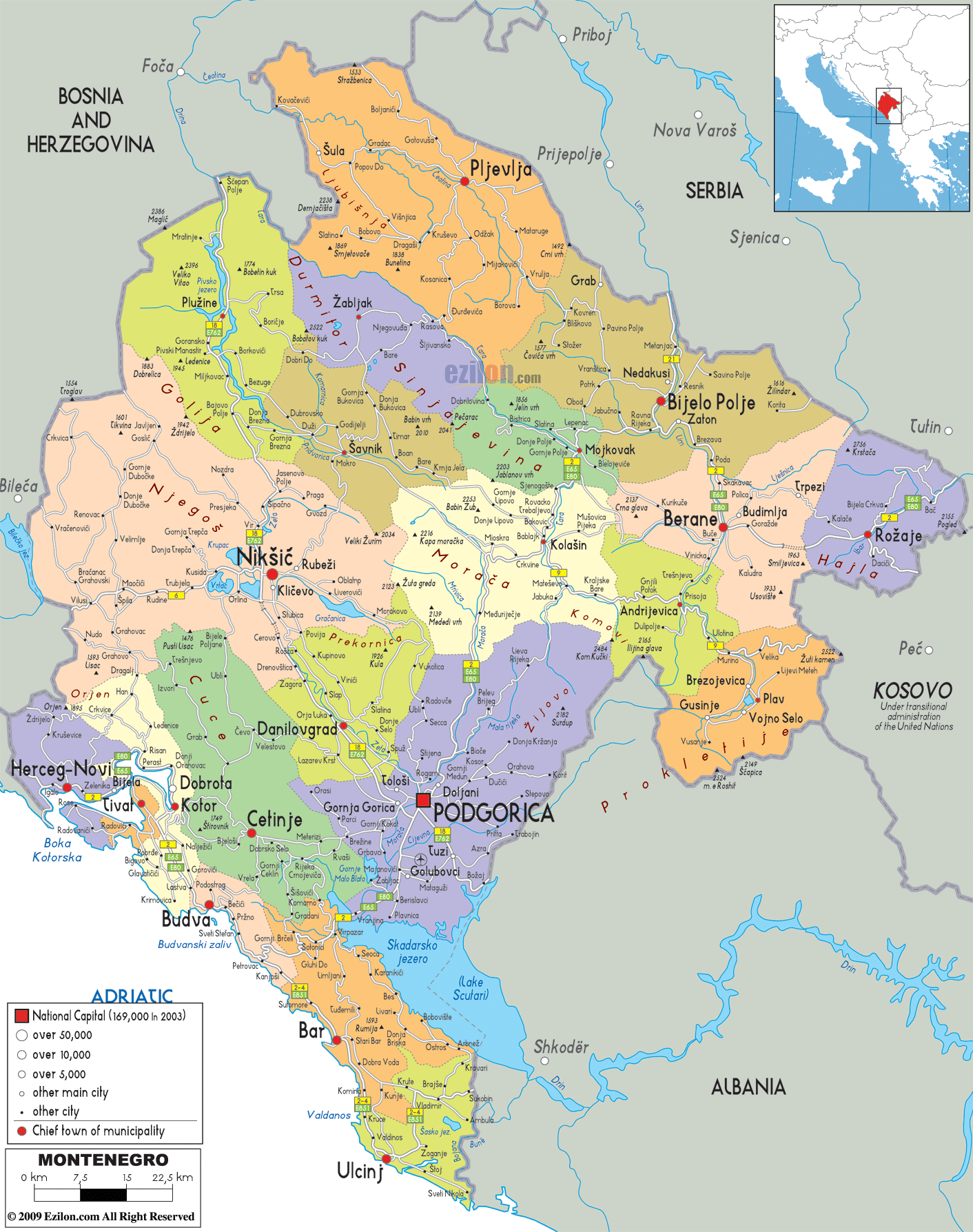
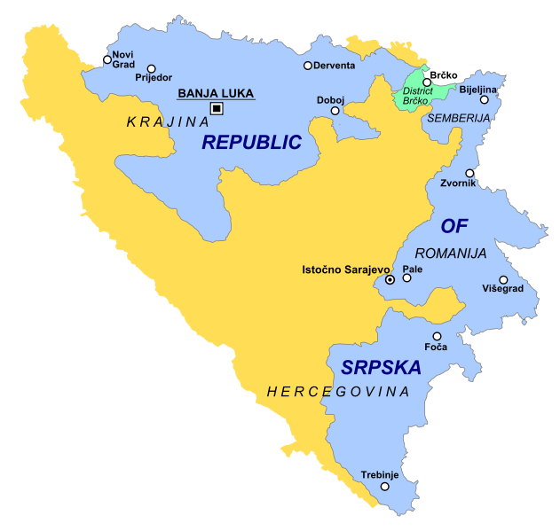
English: Map of Central Balkans in 2010 - showing Bosnia and Herzegovina, Serbia, Montenegro and Kosovo. |
| врѣмѧ сътворѥниꙗ | |
| кладѧꙃь | своѥ творѥниѥ |
| творьць | PANONIAN |
прощєниѥ
I, the copyright holder of this work, hereby publish it under the following license:
| This file is made available under the Creative Commons CC0 1.0 Universal Public Domain Dedication. | |
| The person who associated a work with this deed has dedicated the work to the public domain by waiving all of their rights to the work worldwide under copyright law, including all related and neighboring rights, to the extent allowed by law. You can copy, modify, distribute and perform the work, even for commercial purposes, all without asking permission.
|
References
- http://www.novosti.rs/upload/images/2010/07%20jul/1207/pol-Pet_Oblasti.jpg[dead link]
- http://www.serbiamap.net/maps/mapa-srbija-statisticki-regioni.jpg
- http://www.lokalnirazvoj.org/upload/Book/Image/2012_03/Regions_and_Cities.jpg
- http://www.danas.rs/upload/images/news/2010/2/3/1001_ocp_w222_h313.jpg[dead link]
- http://www.novosti.rs/upload/images/2010/03mar/1203/pol-regioni.jpg[dead link]
- http://static.politika.co.rs/uploads/rubrike/122239/i/1/Untitled-1.jpg[dead link]
- http://www.geographicguide.com/pictures/maps/servia.gif
- http://www.yourchildlearns.com/online-atlas/images/serbia_map.gif
- http://www.smartraveller.gov.au/zwiki/pub/Maps/countries/dfat/Serbia.jpg archive copy at the Wayback Machine
- http://www.zofona.com/images/log84.gif
- http://www.zofona.com/images/log84.gif
- http://wwwnc.cdc.gov/travel/images/map-serbia.png
- http://i.istockimg.com/file_thumbview_approve/18192921/2/stock-illustration-18192921-serbia-vector-map.jpg[dead link]
- http://upload.wikimedia.org/wikipedia/commons/3/37/Kosovo-map.gif
- http://www.smartraveller.gov.au/zwiki/pub/Maps/countries/dfat/Kosovo.jpg archive copy at the Wayback Machine
- http://thumbs.dreamstime.com/thumblarge_374/1236878946ycZqnP.jpg[dead link]
- http://www.lonelyplanet.com/maps/europe/montenegro/map_of_montenegro.jpg
- http://www.i-google-map.com/gfx/maps/big/mj-map.gif
- http://www.ezilon.com/maps/images/europe/Montenegro-political-map.gif
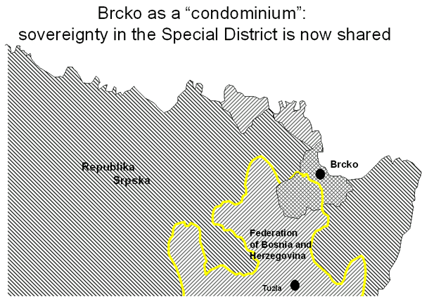
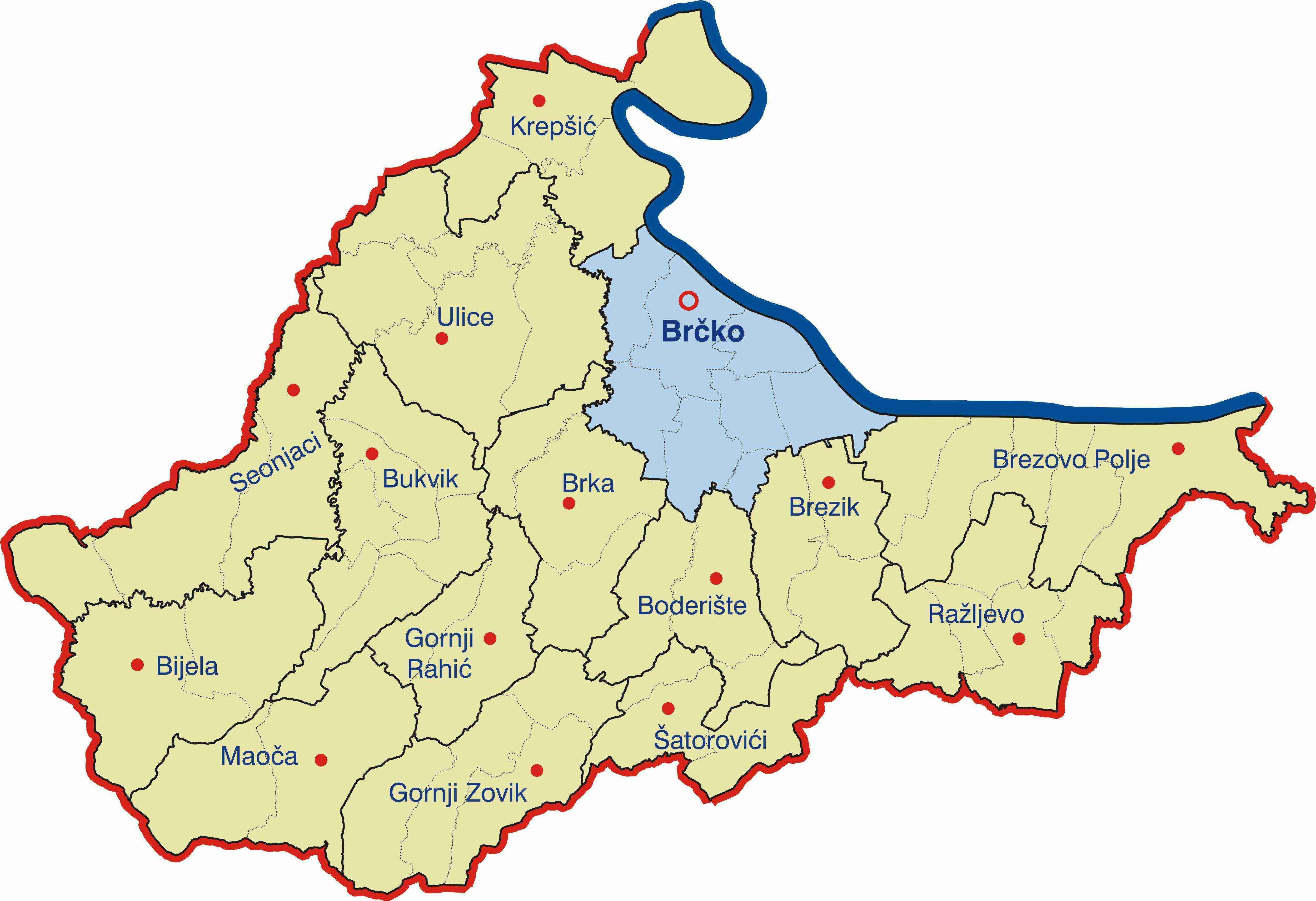
- http://www.ohr.int/ohr-offices/brcko/gen-info/images/brcko-chart-2.gif
- http://bih-x.info/wp-content/uploads/2010/03/Brcko-Distrikt.jpg
- http://www.conflictgeographies.org/uploads/2/6/1/8/2618869/8958714.jpg?490 archive copy at the Wayback Machine
- http://whoruleswhere.files.wordpress.com/2010/10/631px-republika_srpska_simple-svg.png
- United States Department of State
дѣла їсторїꙗ
Click on a date/time to view the file as it appeared at that time.
| дьнь / врѣмѧ | малъ обраꙁъ | мѣра | польꙃєватєл҄ь | опьсаниѥ | |
|---|---|---|---|---|---|
| нꙑнѣщьн҄ь обраꙁъ | 21:22, аѷгоуста 26 числа, 2021 | | 1.128 × 1.040 (135 Х҃Б) | Santasa99 | more npov colors & labels |
| 14:37, апрїлїꙗ 27 числа, 2012 |  | 1.128 × 1.040 (120 Х҃Б) | PANONIAN | {{Information |Description ={{en|1=Map of Central Balkans in 2010 - showing Bosnia and Herzegovina, Serbia, Montenegro and Kosovo.}} |Source ={{own}} |Author =PANONIAN |Date =2012 |Permission = |other_... |
дѣла польꙃєваниѥ
The following page uses this file:
Global file usage
инꙑ мѣста къдє сѥ дѣло польꙃєвано ѥстъ :
- польꙃєваниѥ въ an.wikipedia.org
- польꙃєваниѥ въ ar.wikipedia.org
- польꙃєваниѥ въ ast.wikipedia.org
- польꙃєваниѥ въ ba.wikipedia.org
- польꙃєваниѥ въ be-tarask.wikipedia.org
- польꙃєваниѥ въ be.wikipedia.org
- польꙃєваниѥ въ bg.wikipedia.org
- польꙃєваниѥ въ br.wikipedia.org
- польꙃєваниѥ въ ca.wikipedia.org
- польꙃєваниѥ въ cs.wikipedia.org
- польꙃєваниѥ въ en.wikipedia.org
- польꙃєваниѥ въ eo.wikipedia.org
- польꙃєваниѥ въ es.wikipedia.org
- польꙃєваниѥ въ et.wikipedia.org
- польꙃєваниѥ въ fa.wikipedia.org
- польꙃєваниѥ въ fi.wikipedia.org
- польꙃєваниѥ въ fr.wikipedia.org
- польꙃєваниѥ въ gl.wikipedia.org
- польꙃєваниѥ въ he.wikipedia.org
- польꙃєваниѥ въ hi.wikipedia.org
- польꙃєваниѥ въ hu.wikipedia.org
- польꙃєваниѥ въ it.wikipedia.org
- польꙃєваниѥ въ ja.wikipedia.org
- польꙃєваниѥ въ ka.wikipedia.org
- польꙃєваниѥ въ ko.wikipedia.org
- польꙃєваниѥ въ la.wikipedia.org
- польꙃєваниѥ въ lt.wikipedia.org
- польꙃєваниѥ въ mk.wikipedia.org
- польꙃєваниѥ въ myv.wikipedia.org
- польꙃєваниѥ въ nl.wikipedia.org
- польꙃєваниѥ въ no.wikipedia.org
- польꙃєваниѥ въ oc.wikipedia.org
- польꙃєваниѥ въ pl.wikipedia.org
- польꙃєваниѥ въ pnb.wikipedia.org
- польꙃєваниѥ въ pt.wikipedia.org
- польꙃєваниѥ въ ru.wikipedia.org
- польꙃєваниѥ въ sh.wikipedia.org
View more global usage of this file.