
Дѣло:Location of Balashiha Region (Moscow Oblast).svg

Size of this PNG preview of this SVG file: 631 × 595 пиѯєлъ. Other resolutions: 255 × 240 пиѯєлъ | 509 × 480 пиѯєлъ | 814 × 768 пиѯєлъ | 1.086 × 1.024 пиѯєлъ | 2.172 × 2.048 пиѯєлъ.
источьнъ дѣла обраꙁъ (дѣло SVG · обꙑчьнъ обраꙁъ : 631 × 595 п҃ѯ · дѣла мѣра : 1,22 MB)
| Сь видъ Викикладѣ (Wikimedia Commons) съхранѥнъ ѥстъ ⁙ Cѥ ѥгожє опьсаниѥ ѥстъ |
.svg)
.svg)
| опьсаниѥ |
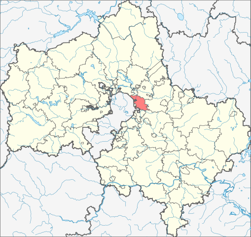
English: Image to indicate Moscow Oblast districts. Subject as indicated by filename. |
| врѣмѧ сътворѥниꙗ | (UTC) |
| кладѧꙃь | |
| творьць |
|
| This is a retouched picture, which means that it has been digitally altered from its original version. The original can be viewed here: Russia Moscow oblast locator map.svg:
|
I, the copyright holder of this work, hereby publish it under the following license:
| I, the copyright holder of this work, release this work into the public domain. This applies worldwide. In some countries this may not be legally possible; if so: I grant anyone the right to use this work for any purpose, without any conditions, unless such conditions are required by law. |
Original upload log
This image is a derivative work of the following images:
- File:Russia_Moscow_oblast_locator_map.svg licensed with PD-self
- 2009-05-15T09:15:53Z Bogomolov.PL 2522x2385 (85328 Bytes) Black oblast boundaries, softer colors
- 2009-04-16T13:57:59Z Bogomolov.PL 2522x2385 (75408 Bytes) Vlasikha and Zvyozdny Gorodok added, Zhukovsky territory expanded
- 2008-07-10T15:02:21Z Bogomolov.PL 1176x1110 (214945 Bytes) {{Information |Description= |Source= |Date= |Author= |Permission= |other_versions= }}
- 2008-07-10T11:56:04Z Bogomolov.PL 1166x1100 (214589 Bytes) {{Information |Description= |Source= |Date= |Author= |Permission= |other_versions= }}
- 2008-07-10T08:18:59Z Bogomolov.PL 1166x1100 (214586 Bytes) {{Information |Description= |Source= |Date= |Author= |Permission= |other_versions= }}
- 2008-07-08T16:03:06Z Bogomolov.PL 1024x966 (211161 Bytes) {{Information |Description= |Source= |Date= |Author= |Permission= |other_versions= }}
- 2008-07-08T15:41:42Z Bogomolov.PL 1024x966 (207452 Bytes) {{Information |Description= |Source= |Date= |Author= |Permission= |other_versions= }}
- 2008-06-24T10:12:26Z Bogomolov.PL 588x555 (185658 Bytes) {{Information |Description={{en|1=Russia_Moscow_oblast_locator_map with simplified boundaries}} {{ru|1=Позиционная карта Московской области с упрощенными границами}} |Sour
дѣла їсторїꙗ
Click on a date/time to view the file as it appeared at that time.
| дьнь / врѣмѧ | малъ обраꙁъ | мѣра | польꙃєватєл҄ь | опьсаниѥ | |
|---|---|---|---|---|---|
| нꙑнѣщьн҄ь обраꙁъ | 09:38, мартїꙗ 7 числа, 2015 | | 631 × 595 (1,22 MB) | Nzeemin | Железнодорожный и Купава теперь часть городского округа Балашиха. |
| 13:50, октѡврїꙗ 4 числа, 2014 |  | 631 × 595 (1,14 MB) | Новик | New bounds of Moscow | |
| 16:31, фєвроуарїꙗ 9 числа, 2010 |  | 2.522 × 2.385 (97 Х҃Б) | Виктор В | {{Information |Description={{en|1=Image to indicate Moscow Oblast districts. Subject as indicated by filename.}} |Source=*Russia_Moscow_oblast_locator_map.svg |Date=2010-02-08 20:32 (UTC) |Author=*[[:File:Rus |
дѣла польꙃєваниѥ
The following page uses this file:
Global file usage
инꙑ мѣста къдє сѥ дѣло польꙃєвано ѥстъ :
- польꙃєваниѥ въ azb.wikipedia.org
- польꙃєваниѥ въ eo.wikipedia.org
- польꙃєваниѥ въ hy.wikipedia.org
- польꙃєваниѥ въ ru.wikipedia.org
- польꙃєваниѥ въ uk.wikipedia.org
- польꙃєваниѥ въ www.wikidata.org
.svg)