
Дѣло:ПозКарта Казахстан.svg

Size of this PNG preview of this SVG file: 744 × 425 пиѯєлъ. Other resolutions: 320 × 183 пиѯєлъ | 640 × 366 пиѯєлъ | 1.024 × 585 пиѯєлъ | 1.280 × 731 пиѯєлъ | 2.560 × 1.462 пиѯєлъ.
источьнъ дѣла обраꙁъ (дѣло SVG · обꙑчьнъ обраꙁъ : 744 × 425 п҃ѯ · дѣла мѣра : 70 Х҃Б)
| Сь видъ Викикладѣ (Wikimedia Commons) съхранѥнъ ѥстъ ⁙ Cѥ ѥгожє опьсаниѥ ѥстъ |
опьсаниѥ
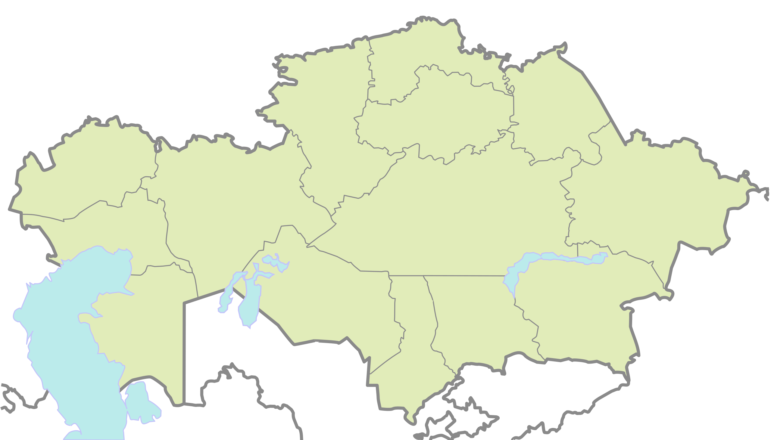
Карта Казахстана в нужной проекции для Шаблон:ПозКарта, вытянутая вертикально в полтора раза и обрезанная ровно по линиям градусов (46° - 88° в.д., 40° - 56° с.ш.).
Map of Kazakhstan, originally in the equirectangular projection (equidistant cylindrical projection, or plate carrée), but stretched vetically 1,5 times (for better appearance). Cropped by 1 degree lines (46° - 88° W, 40° - 56° N).
| опьсаниѥ | for Template:Location map |
| врѣмѧ сътворѥниꙗ | 4 октѡврїи 2007 (upload date) |
| кладѧꙃь |
 |
| творьць | User:Wassily |
прощєниѥ
| I, the copyright holder of this work, release this work into the public domain. This applies worldwide. In some countries this may not be legally possible; if so: I grant anyone the right to use this work for any purpose, without any conditions, unless such conditions are required by law. |
дѣла їсторїꙗ
Click on a date/time to view the file as it appeared at that time.
| дьнь / врѣмѧ | малъ обраꙁъ | мѣра | польꙃєватєл҄ь | опьсаниѥ | |
|---|---|---|---|---|---|
| нꙑнѣщьн҄ь обраꙁъ | 11:00, октѡврїꙗ 4 числа, 2007 | | 744 × 425 (70 Х҃Б) | Wassily | == Summary == Карта Казахстана в нужной проекции для Шаблон:ПозКарта, вытянутая вертикально в полтора раза и обрезанная ров� |
дѣла польꙃєваниѥ
There are no pages that use this file.
Global file usage
инꙑ мѣста къдє сѥ дѣло польꙃєвано ѥстъ :
- польꙃєваниѥ въ de.wikipedia.org